Written by: Tiffany Westry
Need more info? Contact us
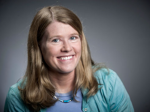
 She has been dubbed a “space archaeologist” and has even been called the real-life Indiana Jones. When archaeologist Sarah Parcak, Ph.D., is not in the classroom inspiring young minds as an associate professor in the University of Alabama at Birmingham College of Arts and Sciences Department of Anthropology, she can be found anywhere from the United States to Scotland, Egypt, and Italy uncovering mysteries of ancient civilizations.
The TED Senior fellow and National Geographic Archaeology Fellow has worked with NASA, the Department of Defense, and collaborators across the globe, and her work has been featured on BBC, National Geographic, CNN, the Discovery Channel, in Science, and in Nature.
Parcak uses earth-facing satellites to collect infrared images in order to locate potential archaeological sites. From hundreds of miles above the earth, once the images are processed, the infrared satellite technology allows Parcak and her team to see what the naked eye cannot: chemical changes in the landscape caused by building materials and activities of those who once inhabited the land. These sites tend to hold a large amount of organic debris, providing a great marker for researchers.
“The debris retains water at a higher rate than the surrounding landscape,” Parcak said. “Satellite images can detect the higher moisture, and that is a strong indicator for a potential site.”
After researching and analyzing images for several years in UAB’s Laboratory for Global Observations, which she founded and directs, Parcak discovered 17 potential pyramids, more than 1,000 tombs and 3,000 ancient settlements in Egypt in 2011. The find was the subject of a BBC documentary, in which Parcak and a team of collaborators confirmed what the images revealed through on-site excavation projects. Using a handheld global positioning system unit, the team was able to find the exact locations of sites identified from satellite images. Also among the discoveries was a detailed street plan of the city of Tanis, once the capital of ancient Egypt and a site made famous by the Indiana Jones film “Raiders of the Lost Ark.”
Parcak and her husband, UAB anthropology professor Greg Mumford, typically travel to Egypt for site visits. Both are field directors for the Survey and Excavation Projects in Egypt Parcak’s primary focus is on ancient Egypt and its antiquities; but the use of remote sensing for archaeological purposes has sparked interest in other parts of the world and within different academic disciplines.
In 2012, Parcak’s research took her to Tunisia, Romania, Jordan, and Italy. Satellite imagery has led to the discovery of forts and military districts belonging to the Roman army, an amphitheater, and the likely location of the famed Portus lighthouse.
“In the past three years, I have been involved in a number of collaborative projects in the Mediterranean, Europe and the United States,” Parcak said. “Most recently, I have been working on a Viking archaeology project. Each landscape is different and may require a different approach. The varying techniques and tools I have to become familiar with have helped me to become much better at doing remote sensing work.”
Expanding horizons
Parcak joined UAB in 2006 and wrote the first textbook on the field of satellite archaeology, “Satellite Remote Sensing for Archaeology”; but her influence is not limited to archaeology. In her Birmingham lab, Parcak helps provide invaluable training for students and has helped students and faculty apply remote sensing techniques to projects far beyond her own area of expertise.
“The most important part of the work I do is that it’s not done in a vacuum,” Parcak said. “Remote sensing, by nature, is incredibly collaborative. You need teams of people with different perspectives and ideas.”
| Since opening her lab in 2007, Parcak has helped students and faculty from many academic areas at UAB. They have explored the use of remote sensing in the areas of anthropology, archaeology, climate change, geographic medicine, epidemiology and dentistry. |
Since opening her lab in 2007, Parcak has helped students and faculty from many academic areas at UAB. They have explored the use of remote sensing in the areas of anthropology, archaeology, climate change, geographic medicine, epidemiology and dentistry. She has helped School of Public Health students explore the use of satellite data to map mosquito breeding grounds in Peru. The School of Dentistry has explored its value for tracking the relationship between water quality and dental health.
“I have worked with students and faculty from just about every area of the university,” Parcak said. “I have been very fortunate with the quality of students who come through my lab. I have hired a number of them to work with me on different archaeological projects.”
Many of those students have gone on to receive professional certifications in the field. Her teaching efforts have resulted in several UAB and national teaching and mentoring awards.
“The students at UAB are only getting smarter and smarter,” Parcak said. “I am excited about the possibility of having more of them come through my lab in the future.”